


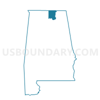
Eastside Community Center, Madison County, Alabama
About
Outline

Summary
| Unique Area Identifier | 522345 |
| Name | Eastside Community Center |
| County | Madison County |
| State | Alabama |
| Area (square miles) | 0.29 |
| Land Area (square miles) | 0.28 |
| Water Area (square miles) | 0.01 |
| % of Land Area | 97.95 |
| % of Water Area | 2.05 |
| Latitude of the Internal Point | 34.73194720 |
| Longtitude of the Internal Point | -86.58636960 |
Maps


Graphs
Select a template below for downloading or customizing gragh for Eastside Community Center, Madison County, Alabama


Neighbors
Neighoring Voting District (by Name) Neighboring Voting District on the Map
- Charles Stone Agricultural Center, Madison County, AL
- Huntsville Middle School, Madison County, AL
- Jackson Way Bapt Church, Madison County, AL
- Phillips CME Church, Madison County, AL